In Survey Solutions all maps are first uploaded to the server, then distributed to the interviewers based on assignments of maps.
This functionality is accessible for the users in roles headquarters and
administrator only.
The Map files page is the page where the maps are managed at the Survey
Solutions server (Headquarters). It can be accessed by
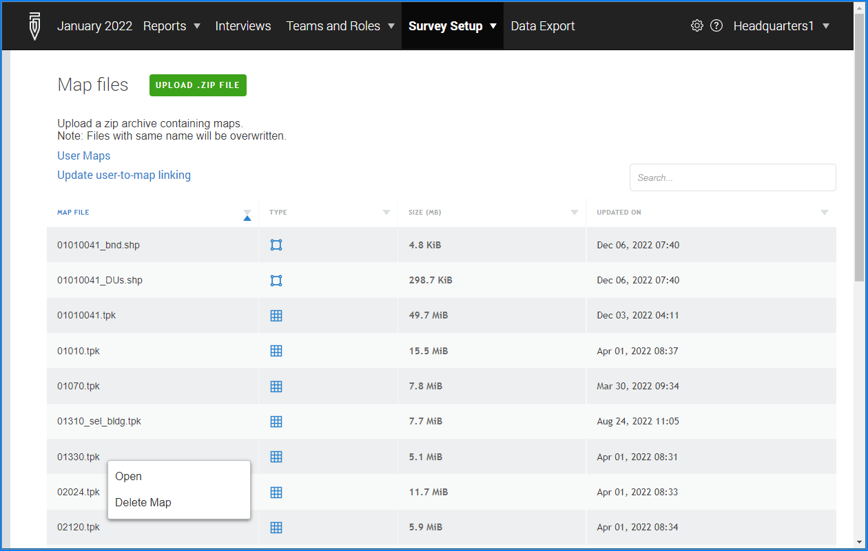
The Maps dialog is using two icons to denote types of the uploaded maps:
![]() for raster maps (tiff, tpk, and mmpk map files);
for raster maps (tiff, tpk, and mmpk map files);
![]() for vector maps (shapefiles).
for vector maps (shapefiles).
Additional information on managing the shapefiles is available in this article: Shapefile maps
The following actions are available here:
- upload maps (via the
Upload mapbutton); - delete a map (from the context menu);
- open a map and see which users are assigned this map (from the context menu);
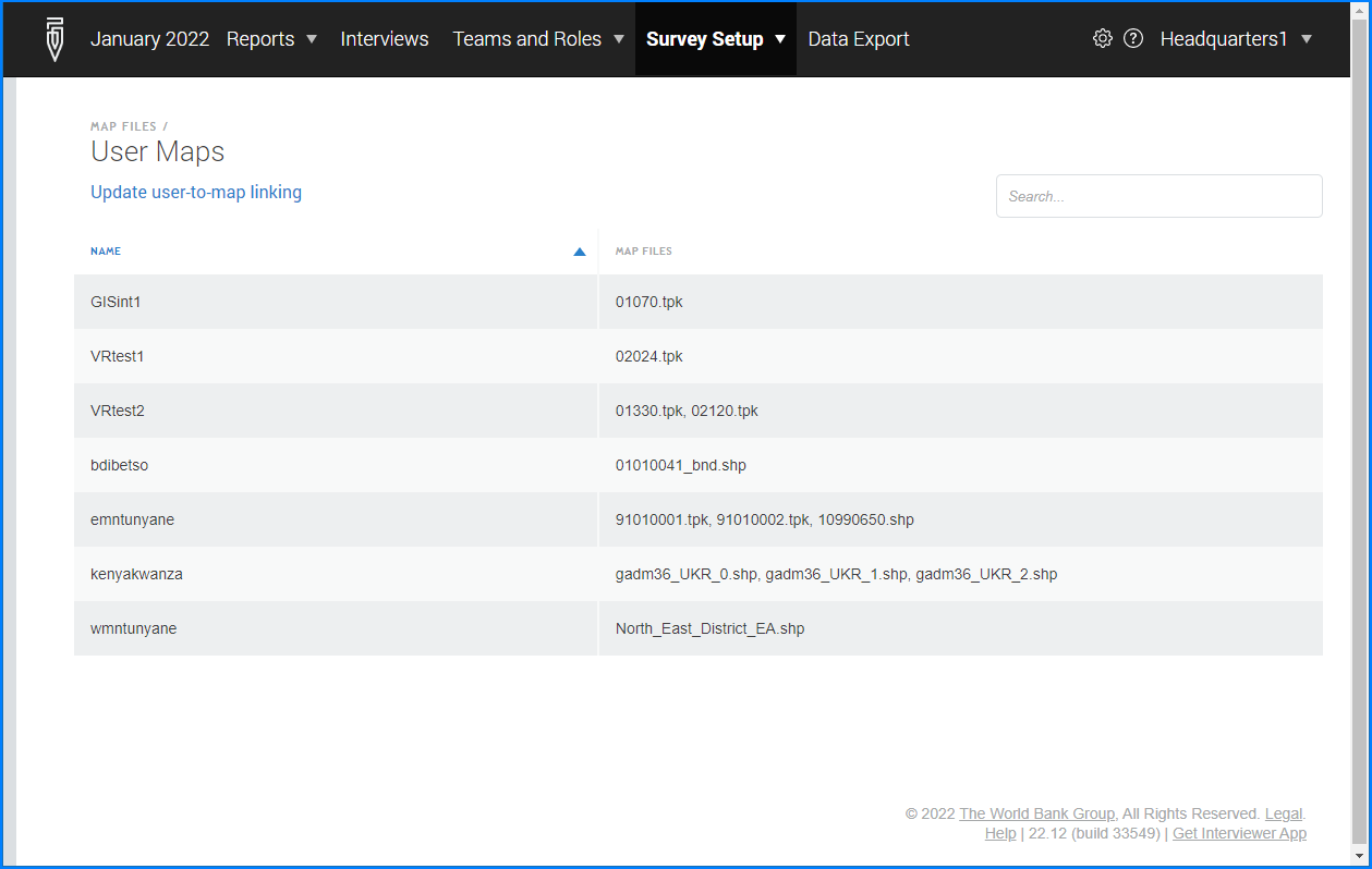
- see maps assigned to users (by following the
User Mapslink); - update assignments of maps to users (by following the
Update user maps linkinglink).
Upload maps
In Survey Solutions all maps are first uploaded to the server, then distributed to the interviewers based on assignments of maps.
One or multiple maps in acceptable map formats
are uploaded in archived form (as a single *.zip archive) by clicking the green
Upload ZIP file button at the Map files page: Survey Setup –> Maps –> Upload ZIP file
Please note that:
- Maps are stored separately by workspaces. If the same map is needed in multiple workspaces it must be uploaded to each such workspace.
- When a map with the same name already exists on the server, it will be overwritten with the new map.
Delete a map
A confirmation is required before a map is deleted:

When a map is deleted, all assignments of that map to users are also deleted. At next synchronization the files corresponding to this map will be erased from the interviewers’ devices.
Open a map
For any given map, the survey manager may preview the map in the Headquarters, and see the users to whom it is assigned.

See maps assigned to users
For any every user, the survey manager can see, which maps are assigned to that user:
Update assignments of maps to users
The map assignments file is a file, which is uploaded to the Survey Solutions Headquarters to regulate which interviewer has access to which offline maps. Online maps need not be assigned to individual users, all users have access to online maps provided that they have received a valid key for online maps usage (entered by administrator in the workspace settings) and have Internet connectivity when attempting to use them.
The offline maps are used by the interviewers to record answers to the geography type questions and for displaying data on the map dashboard. If the survey doesn’t use any geography type question nor records any locations using location sensor (GPS or similar) then no maps need to be assigned.
The map assignment file is formatted as a tab delimited file with two columns:
map must contain unique map names (must correspond to the files uploaded to the server);
users contains the list of the users that have access to the map listed in the first column.
When the map must be available to more than one user, separate their logins in the list with a comma.
It is normal that a user name is mentioned for more than one map. That user will have access to all of the maps where his name was mentioned and no other.
Here is an example of such a file: usermaps.tab.
Uploading the map assignments replaces the previous map assignments. If the map was assigned to an interviewer and subsequently a map assignments file was uploaded that doesn’t contain this map-user pair, then the previosly pushed map will be removed from the interviewer’s tablet at the next maps synchronization.
After the map was assigned to an interviewer, that interviewer needs to synchronize his maps (not data!) to receive the map files. These files may be quite large.
The headquarters users must plan carefully when preparing the map files and assignments to assign only the necessary maps covering the relevant areas. Assigning all maps to all users may result in a huge traffic to the server, waiste of airtime, and clogging of tablets.