Overview of the map dashboard
Survey Solutions map dashboard is an alternative representation of the regular dashboard where markers on the map indicate location of respondents. An interviewer switches to this view by pressing the map icon located in the toolbar next to the synchronization icon on the main dashboard.
Several maps are offered for the Interviewer application (three online maps) and (1 offline map), and more offline maps can be uploaded by the headquarters users using the same procedure as the maps are assigned to be used in the geography-type question. Offline maps usually occupy considerable space in the tablet’s data storage, so only the necessary maps should be assigned to interviewers.
The interviewer may select the map that is appropriate for the enumeration zone that she is working from a list of loaded maps.
ESRI mapping components are utilized to visualize the map. The online maps are provided by various copyright holders, depending on the territory and may vary in recency and level of detail.
The map dashboard indicates location based on the value of a single GPS-location question in the cover page (only one GPS-location question may be designated as) identifying. This means also, that this question may be called differently in different survey questionnaires, and Survey Solutions would still find it and plot on the map.
Warning!
There may be assignments/interviews on the interviewer’s dashboard without geographical position for any of the following reasons:
- there is no GPS question in the questionnaire, or
- location information hasn’t been preloaded into assignments, or
- location information hasn’t been recorded yet, or
- location of the interview is off the current visible map.
Interviewers should double-check with the regular dashboard to conclusively establish the presence and status of a certain interview or assignment.
Map dashboard explained
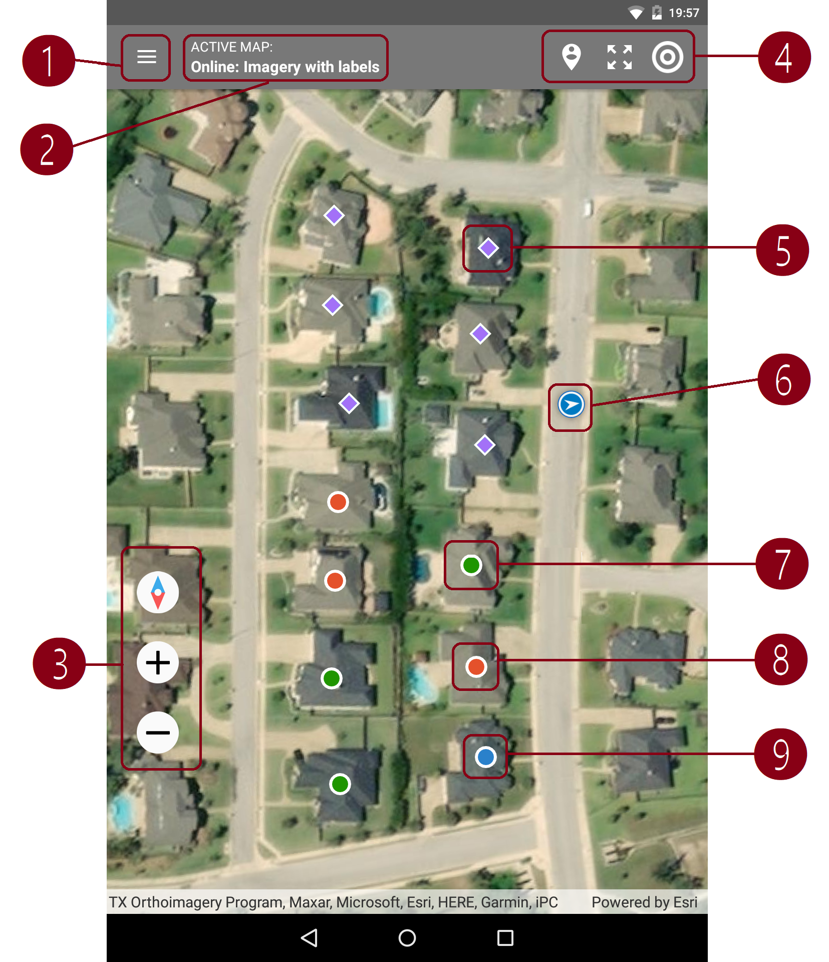
Menu to apply filter by questionnaire and select what to plot: assignments, interviews, or both. When a questionnaire is selected all versions of this questionnaire are treated as if they are the same version.
Active map selector. Interviewers may select any one of the:
- online: imagery;
- online: imagery with labels;
- online: open street map;
- map of the world;
- user-uploaded offline maps.
Controls to:
- align (rotate) the map to point in the North direction at the top of the screen;
- zoom in;
- zoom out.
Controls to:
- zoom to extent of the data;
- zoom to extent of the map;
- show current location marker (may take time to determine position).
Assignment marker - purple diamond: ⯁.
Current location marker - blue circle with an arrow.
Completed interview marker - green circle: ●.
Rejected interview marker - red circle: ●.
Started interview marker - blue circle: ●.