Overlap detection is feature in Survey Solutions’ geography question. It is applicable only to the geography questions placed in a roster. When activated by the questionnaire designer, it will assist the interviewers in marking the areas in such a way that there is no overlap between multiple marked plots/parcels. This is important to avoid double-counting of any area in calculation of the total area.
If an overlap is detected, the program signals about it at the bottom of the map, mentioning the other roster items with which an overlap was detected. Overlap detection works instantaneously, even if the answer to the question has not been saved yet.

Note that the overlap applies to all variants of the geography question: polygon, polyline, multipoint and single point, though most common use is with marking the areas (polygons). An overlap is signaled when there is at least one common point of the current answer with the answer to the same geography question in any other items of the roster. Thus:
- for polygons: when they overlap with at least one common point;
- for polylines: when they intersect in at least one point;
- for multipoints: when there is at least one point common to the current answer and the answer to the same question in a different roster item.
- for single points: when the two points are exactly the same.
In practice, due to noise in measurement no two points in the single and multiple point geography questions will be exactly the same when measured with a sensor (even if the tablet is not moving at all). And if they happened to be the same, it is likely they are sourced not from a location sensor then.
The overlap detection serves a warning purpose only. It doesn’t prevent such data from being recorded and submitted by the interviewer.
The overlap detection applies to all modes of measurement: manual, automatic, and semi-automatic.
When overlap detection is switched on, the answers to the same question for other roster items are displayed on the same map, albeit in a different color:
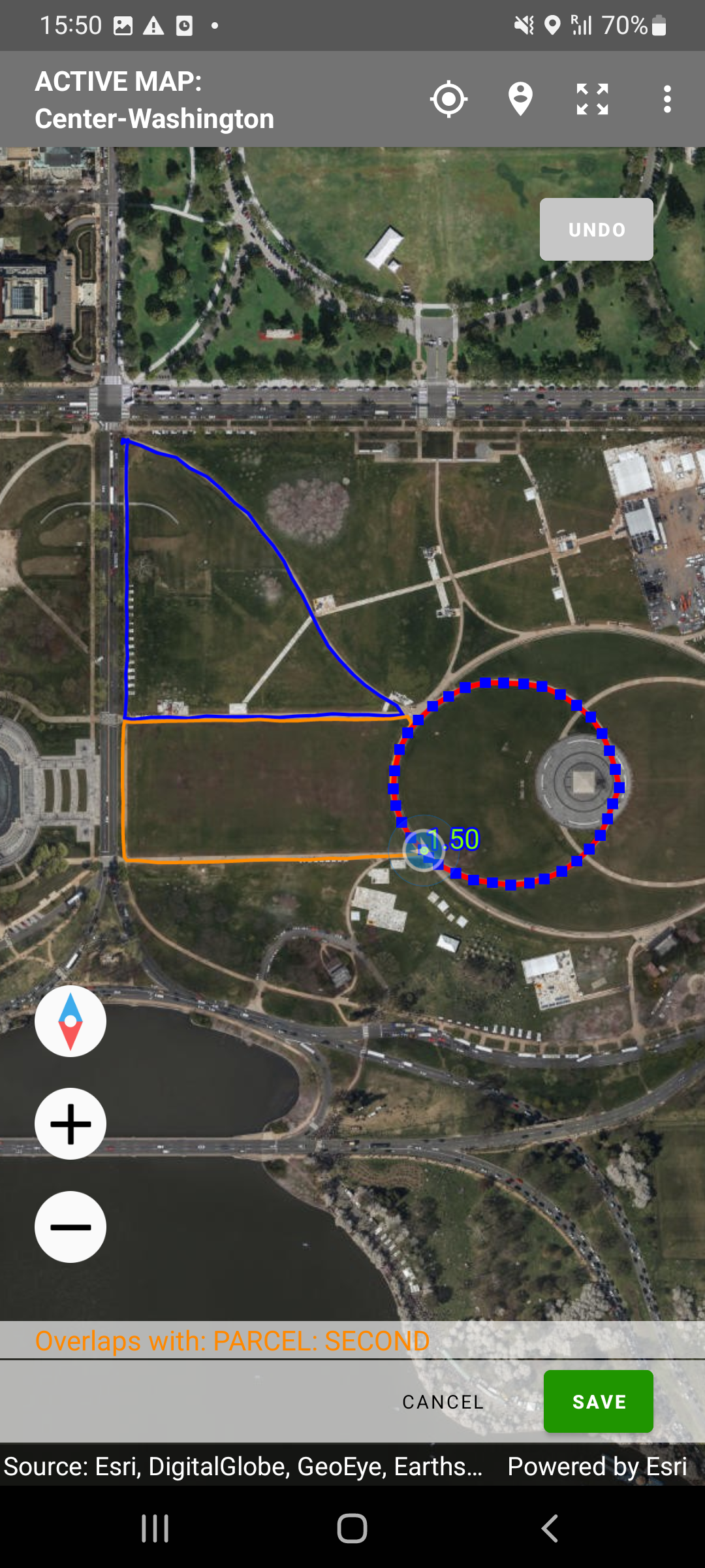
Legend for colors:
- RED - answer to the current geography question (e.g. current parcel);
- BLUE - answers to the same geography question for other roster items (e.g. other parcels), which do not overlap with the current one;
- ORANGE - answers to the same geography question for other roster items (e.g. other parcels) which do overlap with the current one.
The overlap detection does not affect the export of the data, and whether the answer overlaps with another or not is not accessible from the syntax in writing expressions.
To activate overlap detection, tick the corresponding checkbox for those geography questions, where this is desirable.
The supervisors and headquarters users reviewing incoming interviews also have a view of the neighboring parcels and an overlap warning:
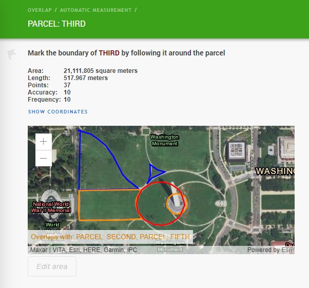
In this example the overlap of the THIRD PARCEL (red circle) with the SECOND PARCEL (orange shape to its left) is detected, but this overlap is marginal and probably due to the noise in the location acquisition. Yet the overlap between the THIRD PARCEL and the FIFTH PARCEL is significant and is clearly double-counting the same area, and thus is likely a mistake.