Description
 A GPS question expects a set of geographic
coordinates (latitude, longitude, accuracy, altitude), which identify
the location of the tablet. This type of question can be answered using
a GPS-enabled tablet.
A GPS question expects a set of geographic
coordinates (latitude, longitude, accuracy, altitude), which identify
the location of the tablet. This type of question can be answered using
a GPS-enabled tablet.
In addition to using a GPS question to get specific locations (e.g. household or enterprise), it can also be used to define the area of a land. An area can be defined by creating GPS questions for each point that defines the land’s area.

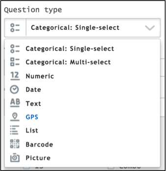
Creating a GPS question
In Questionnaire Designer,
Click on the Question Type text box.
Select GPS from the pop-up menu.
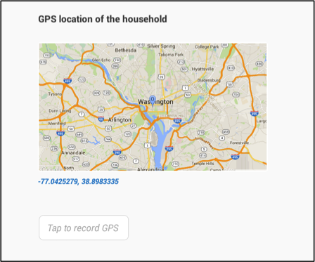
How a GPS question appears on a tablet
To answer a GPS question, the enumerator taps on the Tap to record GPS button and the geographical coordinates will be displayed.

Export
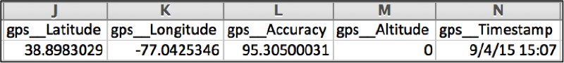
The GPS location is exported in 5 columns (latitude, longitude, accuracy, altitude, and time stamp ) in a tab-delimited file. The name of the exported variable is the question’s variable name that was defined in the Questionnaire Designer
GPS question
Unanswered question exported in tab-delimited file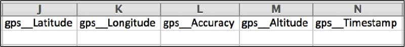
Answered question exported in tab-delimited file